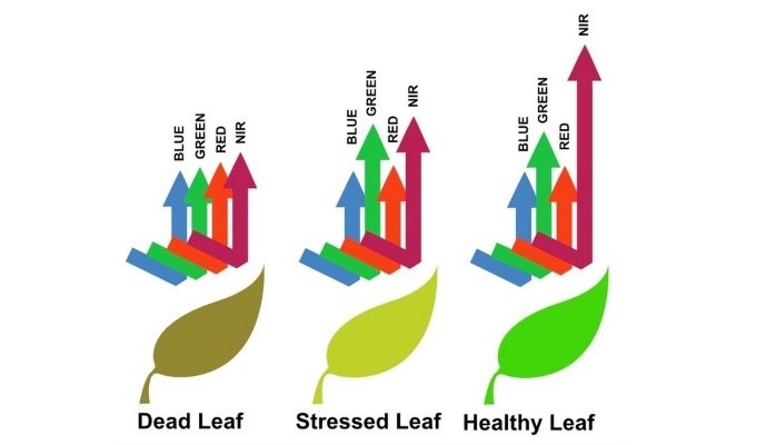
When light interacts with any object, certain wavelengths are absorbed or reflected. Crops draw a significant portion of their energy through photosynthesis by absorbing the sun’s energy and converting it into glucose.
Healthy plants reflect light differently from those that are stressed. Drone imagery really helps make crop scouting easier and more efficient. The aerial view can provide information that is difficult to obtain from the ground.

Standard drone or UAV cameras are designed to capture Red, Green, and Blue light, and RGB plant health maps show the “greenness” of crops.
Although high-resolution RGB cameras detect growth variations, multispectral sensors can analyze plant stress even further using infrared light that the human eye cannot see.
Even regular RGB or true color maps will give a grower or an agronomist highly relevant information—and very often there is a clear correlation between NDVI and RGB data. Each additional data source can be another powerful instrument in the agronomist’s toolbox, helping them to make informed management decisions.
Farm Crop Maps can process both data from [1] regular RGB cameras, and [2] cameras with multispectral sensors.
